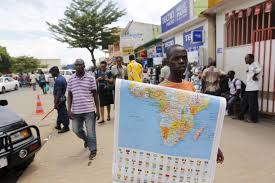
The African Union (AU) is urging global institutions, educators, and map publishers to adopt a more accurate
world map that correctly reflects the true size of the African continent.
The call aims to address centuries of distortion embedded in one of the world’s most widely used map projections.
The move challenges the dominance of the Mercator Projection, a cartographic model developed in 1569 by Flemish cartographer Gerardus Mercator to aid maritime navigation. While revolutionary at the time, Mercator’s map significantly distorts the relative sizes of continents, disproportionately enlarging regions near the poles—such as North America, Europe, and Greenland—while shrinking equatorial regions like Africa and South America.
“For generations, African students have grown up seeing their continent minimized in size and, symbolically, in significance. That must change,” said an AU spokesperson.
While the Mercator map preserves accurate angles for navigation, it sacrifices scale, especially further from the equator. For instance:
Greenland appears similar in size to Africa, when in reality, Africa is over 14 times larger.
Europe appears larger than South America, even though South America is nearly double its size.
Such distortions have long been criticized by scholars, educators, and activists for promoting a Eurocentric worldview and reinforcing colonial-era mindsets that downplay Africa’s geographical—and by extension, geopolitical—importance.
The AU argues that map distortions contribute to global misperceptions about Africa’s scale, resources, and role in the world. These misconceptions can subtly influence how Africa is regarded in terms of economic power, development potential, and political relevance.
“We are not just correcting geography—we are correcting perception,” the AU noted in a statement.
They are advocating for the adoption of more proportionally accurate projections such as the Gall-Peters, AuthaGraph, or Equal Earth maps, which present a true-to-scale representation of landmasses, especially those along the equator.
The AU’s call aligns with a broader global movement that has gained traction in recent years. Several African and Latin American education ministries have already started phasing out the Mercator projection in textbooks, replacing it with maps that restore visual equity among continents.
Some international institutions, including the United Nations Development Programme (UNDP) and environmental NGOs, have already begun using alternative projections in official presentations and publications.
The African Union plans to launch a continent-wide education campaign encouraging the use of accurate maps in schools and media. It will also engage with UNESCO and international mapping organizations to support the shift.